Understanding Boundary Surveys for Property Lines

[ad_1]

Understanding Boundary Surveys for Property Lines

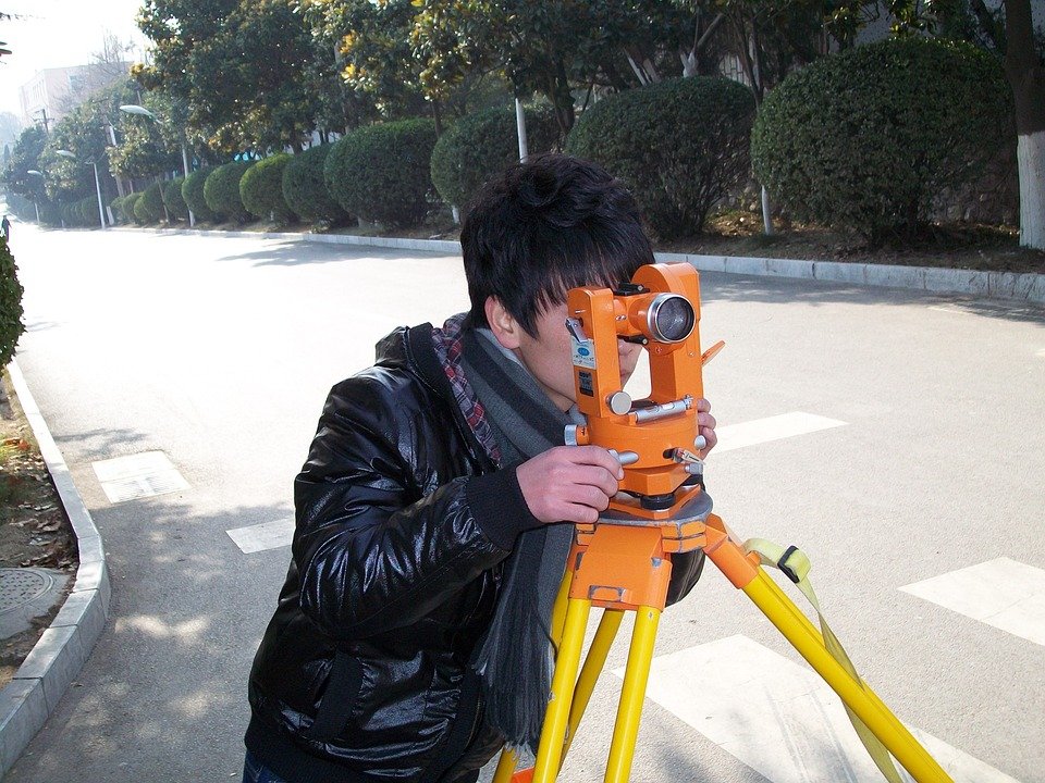
A boundary survey is a type of survey used to determine the exact boundaries of a piece of land. It is often used when a piece of real estate is purchased, leased, or otherwise transferred from one owner to another. Boundary surveys are also used to settle boundary disputes or to confirm the legal description of a parcel of land prior to any development taking place.

What is Involved in a Boundary Survey?

A boundary survey involves a detailed examination of the property in question, taking into account its physical features, legal restrictions, and surrounding properties. It includes measuring distances, locating boundary corners, and researching public records and legal documents. The surveyor creates an official map of the property, accurately marking its boundaries and any existing buildings or features.

Why is a Boundary Survey Important?

A boundary survey is important for several reasons. It provides an accurate record of the property’s boundaries for future reference. It helps identify any encroachments or conflicts between neighboring properties. It is also used as evidence in settling boundary disputes, providing an impartial and authoritative source of information.

What Are Common Types of Boundary Surveys?

There are several types of boundary surveys, depending on the purpose of the survey and the level of detail required. A retracement survey is the most common type of survey used to determine the boundaries of a parcel of land. It involves locating and measuring all markers, monuments, or other physical evidence of the boundary lines.

A boundary line adjustment survey is used to adjust the boundary lines of a parcel of land without changing the area of the parcel. It is typically used when two parcels of land need to be merged or when a boundary needs to be shifted to accommodate a new structure.

A boundary dispute survey is used to settle disagreements between two or more parties over the exact boundaries of a parcel of land. It involves researching public records, interviewing witnesses, and surveying the property in question to provide an accurate and impartial representation of the boundary lines.

What to Look for in a Boundary Surveyor

When looking for a boundary surveyor, it is important to find someone who is experienced and knowledgeable in the field of boundary surveying. They should be familiar with local laws and regulations, as well as the latest surveying technology. They should also have references that you can contact to verify their qualifications.

Conclusion

A boundary survey is a valuable tool for determining the exact boundaries of a piece of land. It is important to find an experienced and knowledgeable surveyor who can provide an accurate and impartial representation of the boundary lines. By understanding the purpose and types of boundary surveys, you can ensure that you have accurate information for future reference.
[ad_2]

How to Assess the Accuracy of a Boundary Survey

[ad_1]

How to Assess the Accuracy of a Boundary Survey

A boundary survey is an important part of any land transaction. It is a legal document that identifies the boundaries of a parcel of land and its ownership. It is essential to ensure that the survey is accurate and that it meets the requirements of the relevant laws and regulations. This article will provide an overview of how to assess the accuracy of a boundary survey.

What is a Boundary Survey?

A boundary survey is a process of accurately determining the boundaries of a parcel of land. It is typically used in the transfer of land ownership and involves measuring the boundaries of the parcel and then mapping them onto a survey plan. The surveyor will also record the location of any existing structures or features on the land. The survey is then used to create a legal document that identifies the boundaries of the land and its ownership.

Assessing Accuracy

When assessing the accuracy of a boundary survey, there are several factors to consider.

Legal Requirements:

The first factor to consider is whether the survey meets the legal requirements of the relevant jurisdiction. This includes the accuracy requirements for the survey, as well as any additional requirements that may be applicable. It is important to ensure that the survey complies with all relevant laws and regulations.

Field Measurements:

The second factor to consider is the accuracy of the field measurements that were taken during the survey. The surveyor will typically use a variety of instruments to measure the boundaries of the parcel. These instruments should be calibrated regularly and checked for accuracy. The surveyor should also be able to provide a record of the measurements that were taken.

Analysis of Data:

The third factor to consider is the accuracy of the data analysis that was conducted. This includes verifying that the measurements were accurate and that the surveyor used appropriate methods to determine the boundaries of the parcel. The surveyor should be able to provide evidence of the accuracy of their analysis.

Mapping Errors:

The fourth factor to consider is the accuracy of the mapping that was done. This includes verifying that the boundaries of the parcel were accurately mapped onto the survey plan. The surveyor should also be able to provide evidence of any errors that occurred during the mapping process.

Expert Opinion:

The fifth factor to consider is the accuracy of the expert opinion that was used to assess the accuracy of the survey. The surveyor should be able to provide evidence of the qualifications and expertise of the expert that was consulted.

Conclusion

A boundary survey is an important part of any land transaction. It is essential to ensure that the survey is accurate and that it meets the requirements of the relevant laws and regulations. This article has provided an overview of how to assess the accuracy of a boundary survey. It is important to consider the legal requirements, the accuracy of the field measurements, the accuracy of the data analysis, the accuracy of the mapping, and the accuracy of the expert opinion that was used to assess the accuracy of the survey.
[ad_2]

Everything You Need to Know About Boundary Surveys

[ad_1]

Everything You Need to Know About Boundary Surveys

Boundary surveys are surveys conducted to determine the exact position of a property’s boundaries. They are an important part of property ownership and can help prevent disputes over land ownership. Boundary surveys are required by law in many states and are often used to settle disputes between neighbors and other parties.

What is a Boundary Survey?

A boundary survey is a survey designed to determine the exact location of a property’s boundaries. Boundary surveys are typically conducted by an experienced and licensed surveyor. The surveyor will use a variety of tools and methods to accurately measure and map the boundaries of a property. This includes the use of ground-penetrating radar, aerial photography, and other surveying techniques.

Why is a Boundary Survey Important?

Boundary surveys are important for a variety of reasons. First and foremost, boundary surveys are required by law in many states. This means that if you are buying or selling property, you must obtain a boundary survey in order to ensure that all boundaries are accurately identified and recorded.

Secondly, boundary surveys can be used to settle disputes between neighbors and other parties. Without an accurate boundary survey, it can be difficult to determine who owns which portion of a property. A boundary survey can provide this information and help settle disputes between parties.

Finally, boundary surveys are important for construction projects. If a construction project is taking place near or on a property’s boundary, a boundary survey can help ensure that all construction is done within the boundaries of the property. This prevents construction from encroaching onto neighboring property.

What Does a Boundary Survey Include?

Boundary surveys typically include measurements of the property’s boundaries, as well as a map of the property. The surveyor will measure the boundaries of the property, including any walls, fences, or other structures. He or she will also determine the location of any monuments or markers that have been placed on the property.

The surveyor will then create a map of the property that includes the boundaries, as well as any monuments or markers. The map will also include an area of uncertainty, which is an area that cannot be accurately surveyed without further investigation. The map will also include a description of the property, including its size, shape, and location.

How Much Does a Boundary Survey Cost?

The cost of a boundary survey can vary greatly depending on the size of the property and the complexity of the survey. Generally, boundary surveys can cost anywhere between a few hundred dollars to several thousand dollars. It is important to note that boundary surveys are typically required by law, so it is important to make sure that you obtain a quality survey that meets all legal requirements.

Conclusion

Boundary surveys are an important part of property ownership and can help prevent disputes over land ownership. Boundary surveys are typically conducted by an experienced and licensed surveyor and include measurements of the property’s boundaries, as well as a map of the property. The cost of a boundary survey can vary greatly, but they typically cost between a few hundred dollars to several thousand dollars.
[ad_2]