The Advent of Vacuum Excavation in Land Surveying

A vacuum excavation truck carefully removes soil around utility lines, revealing precise measurements for modern land surveying

In addressing the role of vacuum excavation within the field of land surveying, we observe the significant shift from traditional methods towards precision-led, technology-based practices. This transition marks an important evolution in ensuring greater accuracy and safety in surveying processes.

History and Evolution of Surveying Techniques

Surveying, as we understand, is an art form with a rich tapestry that intricately weaves into the history of civilisation. Traditional excavation methods, which often involved invasive digging, posed risks to both the surveyors and the surrounding infrastructure. Over the centuries, we’ve witnessed a remarkable transformation in surveying methods fuelled by advances in technology and a continuous pursuit of innovation. From the rudimentary tools of ancient times to the sophisticated equipment of today, the art of surveying has been revolutionised by modern technology.

Principles of Vacuum Excavation Technology

Vacuum excavation, a leap forward in excavation technology, utilises high-pressure water or air to break up soil and remove debris through a powerful vacuum system, commonly referred to as hydrovac or airvac respectively. This non-destructive approach allows us to expose underground utilities with minimal risk of damage. Vacuum excavation’s precision aids in the accurate mapping of subsurface structures, which is crucial for successful land surveying. It presents a clear advancement over traditional excavation methods, ensuring higher safety standards and efficiency in our surveying endeavours.

Enhancing Precision and Safety in Surveying

A vacuum excavation truck carefully exposes underground utilities in a construction site, ensuring precise and safe land surveying

In modern land surveying, the advent of geospatial technology and methods used by companies like Rapid Vac Trucks such as hydrovac has transformed how we approach precision and safety. These advancements allow us to execute surveying tasks with greater accuracy while significantly reducing the risk to both personnel and infrastructure.

Increasing Accuracy with Geospatial Data

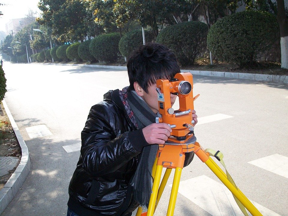
GPS, total stations, drones, satellite imagery, and LiDAR: these tools are integral to our work, offering unparalleled accuracy in capturing geospatial data. By utilising Global Positioning System (GPS) technology, we can determine exact coordinates, ensuring every point of the survey is precise. Total stations contribute to this precision by providing accurate distance, angle, and elevation measurements.

Likewise, drones and satellite imagery broaden our perspective, enabling us to collect data from areas that are otherwise difficult to access. LiDAR technology complements these methods by using pulsed laser light to create highly accurate three-dimensional representations of the surveyed area.

Safety Considerations and Reduced Risks

When uncovering and mapping underground utilities, traditional trenching methods present significant risk of utility strikes and associated injuries. Vacuum excavation, specifically the process known as ‘hydrovac’, mitigates these risks through its non-destructive digging process. Hydrovac uses pressurised water to liquefy soil, which is then removed by a powerful vacuum, revealing underground utilities without direct contact and thereby reducing the likelihood of strikes.

Another method, ‘potholing’, is particularly effective for safely confirming utility locations. This process involves creating small test holes to expose underground assets, ensuring their positions are accurately identified and documented, which significantly cuts down the risk of accidental utility strikes that could otherwise result in injuries or environmental impact. By integrating these methods, we not only enhance the precision of our land surveying but also uphold the safety of our team and the public, whilst concurrently safeguarding the environment.

Operational Efficiency and Environmental Considerations

A vacuum excavation truck carefully exposes underground utilities, surrounded by surveying equipment and workers. The scene showcases the precision and environmental considerations of modern land surveying

In our examination of vacuum excavation and its role in modern land surveying, we focus on the dual benefits of operational efficiency and environmental considerations. Our sector continually pursues ways to reduce environmental impact and maximise cost-effectiveness, and vacuum excavation is at the forefront of this endeavour.

Minimising Environmental Impact through Sustainable Practices

One of the primary environmental benefits of vacuum excavation is its ability to reduce noise pollution, contributing to a quieter and less disruptive process. As a sustainable practice, this method employs a natural lubricant, typically water, which minimises the ecological footprint. The precision inherent in vacuum excavation also significantly lowers the risk of erosion and damage to surrounding landscaping, preserving the natural state of the survey area.

Key Impacts of Vacuum Excavation:

  • Reduces noise pollution
  • Utilises a natural lubricant to minimise ecological footprint
  • Prevents unnecessary erosion
  • Protects surrounding landscaping, reducing the need for remediation

Cost-Effectiveness and Operational Advantages

Vacuum excavation demonstrates its cost-effectiveness by streamlining the surveying process. This efficiency translates to a quicker completion of projects, which inherently results in cost savings. Moreover, the cost-effective nature of this technique is enhanced by its high level of precision, which minimises the risk of inadvertently damaging existing underground utilities — an event that can lead to expensive repairs and delays.

Operational Benefits Include:

  • Increased efficiency with faster project completion
  • Significant cost savings from fewer repairs and decreased downtime
  • Precision in excavation prevents damage to underground utilities

By incorporating vacuum excavation, we not only advocate for an environmentally considerate approach but also promote a more cost-effective and efficient surveying process.

Application in Industry and Urban Development

A vacuum excavation truck carefully uncovers underground utilities in a bustling urban construction site, showcasing the precision and efficiency of modern land surveying techniques

As leaders in modern land surveying, we recognise the transformative impact of vacuum excavation across various sectors. Here, we’ll examine its adoption in the infrastructure and construction industries as well as in utility installation and maintenance, shedding light on its precision and efficiency.

Infrastructure Development and Construction Industry

In the realm of infrastructure development, we’ve observed vacuum excavation playing a pivotal role. It offers non-destructive digging for intricate work where traditional excavation methods pose a risk to underground assets. Used widely in urban development projects, this method supports our commitment to maintaining the integrity of existing services while allowing for progress. Here are some key applications:

  • Service location: Accurately exposing and mapping underground utilities.
  • Potholing: Small, precise holes for site investigation and soil sampling.

Real-life examples, such as the integration of vacuum excavation in the construction of new residential zones, illustrate its proficiency in safely preparing sites without disrupting surrounding structures.

Utility Installation and Maintenance

Moving to utility installation and maintenance, vacuum excavation has become indispensable. It reduces the risk of utility strikes, which are both costly and hazardous. The mining industry also harnesses vacuum excavation to locate and protect subterranean assets before commencing operations. Key benefits in this sector include:

In maintenance operations, vacuum excavation is the tool of choice for exposing buried pipes and cables, allowing for clear access with minimal environmental disruption.

Through our collective endeavours in these fields, vacuum excavation has demonstrated its vital role in fostering sustainable and precise development practices, aligning with the meticulous needs of modern industry and urban growth.

Emerging Technologies and Future Outlook

A vacuum excavation truck operates on a construction site, using precise technology to uncover underground utilities for a modern land surveying project

In the realm of land surveying, we are witnessing a significant shift thanks to the integration of modern technology. The future is being shaped by sophisticated data collection methods and the introduction of new regulations that guide our profession.

Integrating Advanced Mapping and Analysis Methods

Our present capabilities in mapping and analysis have been vastly boosted by technological advancements such as GPS and LIDAR, which enable us to attain groundbreaking precision in land surveying. Innovations in these areas not only provide us with comprehensive geographic information but also facilitate enhanced decision-making for various engineering projects. Incorporating satellite imagery and geographic information systems (GIS) into our workflows allows us to analyse data with greater mathematical accuracy.

The power of these technologies lies in their ability to not just gather but to intelligently process and understand the topography. For instance, LIDAR technology allows us to create three-dimensional representations of surveyed areas, giving us an unprecedented level of detail that informs our engineering solutions.

Legislation and Industry Standards

Compliance with regulations and industry standards is at the core of our adherence to best practices within the land surveying profession. As new technologies emerge, so too do the legislative frameworks that govern their use. It’s crucial for us to stay abreast of these changes to ensure that our methods remain legally compliant and reflect the latest industry benchmarks.

In our commitment to excellence, we remain vigilant of the updates in legislation that affect data collection and the deployment of advanced surveying technology. This is particularly pertinent as it influences the integrity and reliability of the geographic information we provide, whether it’s for urban planning, infrastructure development, or environmental monitoring. Adaptation to these changes is not optional; it is integral to our ongoing ability to offer precise, reliable survey results that stand up to scrutiny in an ever-evolving global landscape.

Frequently Asked Questions

A vacuum excavation truck carefully exposes underground utilities in a modern land surveying scene

We aim to address common queries regarding the integration of vacuum excavation in land surveying and the significant benefits it presents in terms of precision, safety, and efficiency.

What are the primary benefits of employing vacuum excavation in land surveying?

One of the main benefits is the precise excavation capabilities, which minimise the risk of damaging underground utilities. It also reduces the impact on surrounding soil structures, maintaining the integrity of the survey area.

How is vacuum excavation implemented in the process of precision surveying?

In precision surveying, vacuum excavation is used to expose underground utilities with minimal disruption. A vacuum truck removes soil with controlled high-pressure air or water, clearing the way for accurate mapping and analysis.

What distinguishes suction excavation from traditional excavation methods?

Suction excavation stands out for its non-destructive nature, using a vacuum to lift soil rather than mechanical means. This non-invasive method ensures the safety of underground assets and causes less disturbance to the site.

In what scenarios is vacuum excavation the most advantageous for surveyors?

Vacuum excavation is most advantageous when working in congested or environmentally sensitive areas where traditional excavating equipment may be too intrusive or could potentially cause damage.

Can you outline the safety advantages of using vacuum excavation over manual digging techniques?

Vacuum excavation offers considerable safety advantages, notably reducing the risk of injury to workers from striking utilities or performing labour-intensive manual digging. It’s a safer alternative that also protects underground infrastructure.

How does vacuum excavation contribute to the accuracy and efficiency of subsurface utility mapping?

Vacuum excavation contributes to the accuracy of subsurface utility mapping by allowing us to visually verify underground features. The technique is precise, efficient, and avoids the guesswork often associated with traditional digging methods, providing us with a dependable means of identifying and mapping subterranean utilities.

Understanding the Basics of Engineering Surveys

[ad_1]

Understanding the Basics of Engineering Surveys

Engineering surveys are an important component in the process of various engineering projects, such as building roads, bridges, dams and other structures. They provide critical data that is used to determine the design, layout, and construction of these projects. In order to get the most accurate information, it is important to understand the basics of engineering surveys.

Types of Engineering Surveys

There are several different types of engineering surveys. The most common type is the topographic survey, which is used to map the terrain of an area. This type of survey is typically used in the planning stages of a project in order to determine the best layout and design. Other types of surveys include boundary surveys, which are used to establish property lines; hydrographic surveys, which are used to map bodies of water; and control surveys, which are used to establish a baseline for a project.

Tools Used in Engineering Surveys

In order to get accurate data, engineers must use a variety of tools and techniques in their surveys. The most common tool is a total station, which is a surveying tool that uses electronic distance measuring (EDM) technology to measure angles and distances. Other tools that may be used include theodolites, GPS receivers, and laser scanners.

Collecting Data

Once the survey tools are set up, engineers will begin collecting data. This data will typically include elevation, slope, and other measurements. The data is then recorded in a field book and can be used to create maps and diagrams.

Analyzing the Data

Once the data has been collected, it must then be analyzed and interpreted. This is a crucial step in the engineering survey process, as it allows engineers to make informed decisions about the design and layout of a project. The data can be used to identify potential issues that must be addressed, as well as any risks that may be associated with the project.

Conclusion

Engineering surveys are a critical component in the process of engineering projects. They provide the data needed to make informed decisions about the design and layout of a project. In order to get the most accurate results, it is important to understand the basics of engineering surveys, including the types of surveys, the tools used, and how to analyze and interpret the data. With the right knowledge and expertise, engineers can ensure that their projects are designed and constructed correctly.
[ad_2]

How to Choose the Right Site Survey Method

[ad_1]

How to Choose the Right Site Survey Method

A site survey is a vital part of any construction project. It helps to determine the boundaries of the land, identify what type of soil is present, and assess the overall site conditions. It also helps to ensure that the project can be completed without any major issues. With so many different site survey methods available, it can be difficult to know which one is right for your project. In this article, we’ll discuss how to choose the right site survey method for your project.

Consider Your Goals and Objectives

Before you begin your search for the right site survey method, it’s important to consider your goals and objectives for the project. What do you want to accomplish with the survey? Are you looking to identify boundaries or gather data about soil type? Knowing your goals and objectives will help you narrow down the list of potential survey methods and make the selection process easier.

Understand the Different Types of Surveys

Once you’ve determined your project goals and objectives, it’s time to learn about the different types of surveys that are available. Some of the most common types of surveys include topographical, geotechnical, and hydrographic surveys. Each of these surveys has its own advantages and disadvantages, so it’s important to understand the differences between them before making a decision.

Evaluate the Cost

The cost of the survey is another important factor to consider when choosing the right site survey method. Different survey methods may have different costs associated with them, so it’s important to get an estimate of the cost before making a decision. Make sure to compare the estimates of various survey methods to ensure you’re getting the best value for your money.

Check the Availability of the Method

Some survey methods may not be available in certain areas, so it’s important to check the availability of the method you’re considering. You should also make sure that the surveyor you’re working with has the necessary experience and expertise to perform the survey.

Consider the Timeframe

The timeframe for the survey is also an important consideration. Different survey methods take different amounts of time to complete, so it’s important to make sure that the survey can be completed within the timeframe you’re working with.

Get Recommendations

If you’re still having difficulty deciding which survey method is right for your project, it can be helpful to get recommendations from other professionals in the field. Talk to local surveyors, engineers, and other professionals who have experience with the survey method you’re considering. They can provide insight into the pros and cons of each method and help you make an informed decision.

Conclusion

Choosing the right site survey method for your project can be a challenging task. By understanding your project goals and objectives, evaluating the cost of the survey, checking the availability of the method, and getting recommendations from other professionals, you can make sure you’re selecting the best survey method for your project.
[ad_2]

The Pros and Cons of Using Construction Surveys

[ad_1]

The Pros and Cons of Using Construction Surveys

Construction projects are complex endeavors that require a significant amount of coordination and planning. To ensure that the project is completed successfully, it is important to have a good understanding of the construction site and the progress of the project. One way to do this is to use construction surveys. A construction survey is a tool used to collect information about the site, project progress, and other relevant data. In this article, we will discuss the pros and cons of using construction surveys.

Pros

Accurate Measurements

One of the primary advantages of using construction surveys is that they can provide accurate measurements. By using specialized tools, such as laser levels and theodolites, surveyors can measure the size, shape, and elevation of a construction site with great accuracy. This data can then be used to plan and execute the project more effectively.

Improved Safety

Another advantage of using construction surveys is that they can help improve safety on the job site. Surveys can be used to identify potential hazards and to create a safer work environment for everyone involved. For example, surveys can be used to identify potential fall hazards or determine the best location for safety equipment.

Cost Savings

Construction surveys can also help to save money on a project. By accurately measuring the site, surveyors can help to identify potential problems before they arise. This can help to reduce the cost of materials and labor, as well as avoid costly delays.

Cons

Time-Consuming

One of the primary disadvantages of using construction surveys is that they can be time-consuming. Surveying a site is a labor-intensive process that can take days or even weeks to complete. This can add time and cost to a project, making it more expensive than it needs to be.

Expense

Another downside of using construction surveys is the expense. Hiring a surveyor can be costly, and the cost of the equipment needed can add up quickly. Additionally, if the survey is not completed properly, it could lead to additional costs in the form of delays or errors.

Outdated Data

Finally, construction surveys can become outdated quickly. As the project progresses, the data collected by the surveyors can become less accurate. This can lead to errors in the project, which can be costly to fix.

Conclusion

Construction surveys can be a valuable tool for any construction project. They can provide accurate measurements and help to improve safety on the job site. However, they can also be time-consuming and expensive. Ultimately, the decision to use construction surveys should be based on the specific needs of the project.
[ad_2]

Unlocking the Potential of Commercial Surveys for Market Research

[ad_1]

Unlocking the Potential of Commercial Surveys for Market Research

Commercial surveys offer a cost-effective and efficient way for businesses to gather insights into their target market, enabling them to make informed decisions about their products and services. By leveraging the power of survey data, businesses can gain valuable insights into customer preferences, behaviors, and motivations, allowing them to develop effective strategies for engaging and retaining their target audiences.

What is a Commercial Survey?

A commercial survey is a type of market research that uses survey questionnaires to gather feedback from a large number of people. This feedback can be used to inform decisions about product design, pricing, and marketing strategies. Unlike traditional surveys, which are often conducted in-person, commercial surveys are typically administered online, allowing businesses to quickly and easily reach thousands of potential customers.

Benefits of Commercial Surveys

Commercial surveys offer many benefits to businesses, including:

  • Cost-effectiveness: Commercial surveys are much more cost-effective than traditional market research methods, such as focus groups or in-person interviews.
  • Speed: Surveys can be quickly administered and the results are available almost immediately.
  • Reach: Surveys can reach thousands of potential customers in a short amount of time.
  • Accuracy: Surveys are designed to gather accurate and reliable information from respondents.
  • Data Analysis: Surveys provide rich data that can be analyzed to identify trends, patterns, and correlations.
  • Flexibility: Surveys can be customized to meet the specific needs of businesses.

Types of Commercial Surveys

There are a variety of commercial surveys that businesses can use to collect market research data. Some of the most common types of surveys include:

  • Customer Satisfaction Surveys: These surveys measure customer satisfaction with a product or service, allowing businesses to identify areas for improvement.
  • Product Development Surveys: These surveys are used to collect feedback on product design, features, and usability.
  • Market Segmentation Surveys: These surveys are used to identify the needs and preferences of different customer segments.
  • Brand Awareness Surveys: These surveys measure a brand’s recognition and reputation among customers.
  • Pricing Surveys: These surveys are used to determine the optimal price for a product or service.
  • Competitor Analysis Surveys: These surveys are used to compare a business’s products and services to those of its competitors.

How to Use Commercial Surveys for Market Research

When using commercial surveys for market research, businesses should keep the following tips in mind:

  • Develop Clear Goals: Before launching a survey, businesses should define their research objectives and determine what type of data they need to collect.
  • Create Engaging Questions: Questions should be clear and concise, and should focus on the topics that are most relevant to the research objectives.
  • Choose an Appropriate Sample Size: The sample size should be large enough to provide reliable data, but not so large that it overwhelms respondents.
  • Provide Incentives: Offering incentives, such as discounts or gift cards, can encourage respondents to complete the survey.
  • Analyze the Results: Once the survey is complete, businesses should analyze the data to gain valuable insights into their target market.
  • Take Action: The data gathered through the survey should be used to inform decisions about product design, pricing, and marketing strategies.

Conclusion

Commercial surveys offer businesses a cost-effective and efficient way to gain insights into their target market. By leveraging the power of survey data, businesses can identify customer preferences, behaviors, and motivations, allowing them to develop effective strategies for engaging and retaining their target audiences. By following the tips outlined above, businesses can unlock the potential of commercial surveys for market research.
[ad_2]

How to Use Residential Surveys to Gather Important Data

[ad_1]

How to Use Residential Surveys to Gather Important Data

In today’s world, data is the lifeblood of businesses. Businesses rely on data to make informed decisions and understand their customers better. Residential surveys are one of the most effective ways to gather important data. By surveying residential communities, businesses can gain valuable insights into their customers’ needs and preferences.

Residential surveys are a great way to collect qualitative and quantitative data. Qualitative data is used to understand the opinions and motivations of your customers. It includes open-ended questions that allow you to gather insights on customer attitudes and behaviors. Quantitative data is used to collect factual information about your customers such as age, gender, income, and educational level. By collecting both types of data, you can gain a better understanding of your customer base and tailor your products and services accordingly.

Steps to Conduct a Residential Survey

Conducting a residential survey is a straightforward process. Here are the steps you need to take to get started:

Step 1: Identify Your Target Audience

The first step in conducting a residential survey is to identify your target audience. You need to determine who you want to survey and why. Consider factors such as location, age, gender, and income level.

Step 2: Develop Your Survey Questions

Once you’ve identified your target audience, you need to develop your survey questions. Make sure the questions are relevant to your target audience and that they will provide the data you need. Avoid leading questions and keep the survey short and concise.

Step 3: Choose Your Survey Method

There are several methods you can use to conduct a residential survey. You can distribute surveys in person, through the mail, or electronically. Consider the cost and time associated with each method and choose the one that best fits your needs.

Step 4: Administer the Survey

Once you’ve chosen your survey method, you need to administer the survey. Make sure to follow through with the method you’ve chosen and provide incentives to encourage people to respond.

Step 5: Analyze the Results

Once the survey is complete, you need to analyze the results. Look for patterns and trends in the data and use it to inform your decision-making.

Benefits of Residential Surveys

Residential surveys provide a wealth of information about your customers. By gathering data from residential communities, you can gain insights into customer needs and preferences and tailor your offerings accordingly. Additionally, residential surveys can provide valuable market research to help you make informed decisions about your business.

Conclusion

Residential surveys are an effective way to gather important data about your customers. By identifying your target audience, developing relevant survey questions, and choosing the right survey method, you can gain valuable insights into customer needs and preferences. Additionally, residential surveys can provide valuable market research to help you make informed decisions about your business.
[ad_2]

How to Choose the Right Topographic Survey for Your Project

[ad_1]

How to Choose the Right Topographic Survey for Your Project

Topographic surveys are a valuable tool for any project that requires detailed information about the land. They provide an accurate visual representation of the terrain, including elevation, contours, and other physical features. Choosing the right topographic survey for your project is essential for ensuring accuracy and reliability. Here are some tips for choosing the right topographic survey for your project.

Consider Your Project Needs

The first step in selecting the right topographic survey for your project is to consider your project requirements. For example, if you’re building a new road, you’ll need to ensure that the survey accurately captures the contours of the land. If you’re planning to build a large structure, you’ll need to ensure that the survey captures the elevation of the land to ensure that it meets the necessary requirements. By understanding your project needs, you’ll be able to select a topographic survey that meets those needs.

Choose the Right Survey Method

Once you’ve determined your project needs, you’ll need to choose the right survey method. There are several different survey methods available, including aerial surveying, ground surveying, and photogrammetry. Each method has its own advantages and disadvantages, so it’s important to consider the pros and cons of each before making a decision. Additionally, the type of project you’re undertaking will determine which survey method is most suitable. For example, aerial surveying is often the best choice for large projects.

Consider the Cost of the Survey

The cost of a topographic survey can vary greatly depending on the survey method you choose and the size of the project. For smaller projects, a ground survey may be sufficient, while aerial surveys may be necessary for larger projects. Additionally, the cost of the survey can vary depending on the accuracy and detail required. It’s important to consider the cost of the survey before making a decision, as it can have a significant impact on the overall cost of the project.

Get a Detailed Report

Once you’ve chosen the right survey method for your project, you’ll need to get a detailed report. The report should include all of the information captured by the survey, such as elevation, contours, and other physical features. Additionally, the report should include information about any potential hazards that could affect the project, such as unstable ground or hazardous areas. A detailed report will ensure that you have all the information you need to make informed decisions about your project.

Choose an Experienced Surveyor

Finally, it’s important to choose an experienced surveyor. An experienced surveyor will have the necessary knowledge and expertise to accurately capture all of the information required for your project. Additionally, they’ll be able to provide you with additional advice and guidance on the best survey methods and techniques. It’s important to choose a surveyor who has a good reputation and has experience in the type of survey you require.

Choosing the right topographic survey for your project is essential for ensuring accuracy and reliability. By considering your project needs, choosing the right survey method, and selecting an experienced surveyor, you’ll be able to select the perfect topographic survey for your project.
[ad_2]

Understanding Boundary Surveys for Property Lines

[ad_1]

Understanding Boundary Surveys for Property Lines

A boundary survey is a type of survey used to determine the exact boundaries of a piece of land. It is often used when a piece of real estate is purchased, leased, or otherwise transferred from one owner to another. Boundary surveys are also used to settle boundary disputes or to confirm the legal description of a parcel of land prior to any development taking place.

What is Involved in a Boundary Survey?

A boundary survey involves a detailed examination of the property in question, taking into account its physical features, legal restrictions, and surrounding properties. It includes measuring distances, locating boundary corners, and researching public records and legal documents. The surveyor creates an official map of the property, accurately marking its boundaries and any existing buildings or features.

Why is a Boundary Survey Important?

A boundary survey is important for several reasons. It provides an accurate record of the property’s boundaries for future reference. It helps identify any encroachments or conflicts between neighboring properties. It is also used as evidence in settling boundary disputes, providing an impartial and authoritative source of information.

What Are Common Types of Boundary Surveys?

There are several types of boundary surveys, depending on the purpose of the survey and the level of detail required. A retracement survey is the most common type of survey used to determine the boundaries of a parcel of land. It involves locating and measuring all markers, monuments, or other physical evidence of the boundary lines.

A boundary line adjustment survey is used to adjust the boundary lines of a parcel of land without changing the area of the parcel. It is typically used when two parcels of land need to be merged or when a boundary needs to be shifted to accommodate a new structure.

A boundary dispute survey is used to settle disagreements between two or more parties over the exact boundaries of a parcel of land. It involves researching public records, interviewing witnesses, and surveying the property in question to provide an accurate and impartial representation of the boundary lines.

What to Look for in a Boundary Surveyor

When looking for a boundary surveyor, it is important to find someone who is experienced and knowledgeable in the field of boundary surveying. They should be familiar with local laws and regulations, as well as the latest surveying technology. They should also have references that you can contact to verify their qualifications.

Conclusion

A boundary survey is a valuable tool for determining the exact boundaries of a piece of land. It is important to find an experienced and knowledgeable surveyor who can provide an accurate and impartial representation of the boundary lines. By understanding the purpose and types of boundary surveys, you can ensure that you have accurate information for future reference.
[ad_2]

How to Become a Land Surveyor: Education, Training & Certification

[ad_1]

How to Become a Land Surveyor: Education, Training & Certification

Becoming a land surveyor requires an education in surveying, on-the-job training, and certification. Land surveyors are responsible for measuring and mapping the land, including boundaries, terrain, and elevation. They must understand and apply the principles of mathematics, geometry, and physics, as well as local laws and ordinances, to accurately measure and record the characteristics of the land.

Education Requirements

The minimum education requirement to become a land surveyor is an associate degree in surveying or a related field such as engineering or geography. Most students obtain a bachelor’s degree in surveying, engineering, or a related field. Courses in mathematics, physics, and computers are important for land surveyors and are often included in a surveying or engineering program.

Training and Experience

After graduation, land surveyors must receive on-the-job training and experience to become certified. During this period, surveyors learn the principles of surveying, how to use surveying tools, and other skills. This period typically lasts from one to four years, depending on the state. During this time, surveyors work under the direct supervision of a certified surveyor.

Certification

To become a certified land surveyor, applicants must pass a comprehensive exam. This exam includes questions on mathematics, surveying theory, and surveying practice. In addition, applicants must fulfill any additional requirements set by their state. These requirements can include work experience, continuing education, and other qualifications. After passing the exam and meeting the state requirements, surveyors are awarded a certificate of registration.

Continuing Education

To maintain their license, land surveyors must participate in continuing education programs. These programs keep surveyors up-to-date on new technology, laws, and regulations related to surveying. Additionally, they must complete a certain number of hours of continuing education every year, depending on the state.

Conclusion

Becoming a land surveyor requires an education, training, and certification. The minimum education requirement is an associate degree, while a bachelor’s degree is preferred. Surveyors must receive on-the-job training and experience and pass a comprehensive exam to become certified. To maintain their license, land surveyors must participate in continuing education programs. With the right education, training, and certification, land surveyors can enjoy a rewarding career.
[ad_2]

The Role of Technology in Land Surveying

[ad_1]

The Role of Technology in Land Surveying

Land surveying is the science and art of accurately measuring and mapping land areas. It is a profession that has been around since ancient times and has evolved significantly over the centuries. In recent years, the use of technology has revolutionized the field of land surveying, making it more accurate and efficient than ever before.

GPS

GPS (Global Positioning System) is one of the most important tools used in land surveying. With GPS, surveyors are able to measure distances and angles accurately, and record data points for later use. GPS also allows surveyors to get an accurate picture of the area they are surveying, which can be incredibly useful for creating maps and plans.

Lasers

Laser technology has also become an important tool for land surveyors. Laser scanning is used to identify features in the landscape that can’t be seen with the naked eye. This data can then be used to create accurate maps and plans. Laser scanners are also used to measure distances and angles accurately, and they can be used in areas where GPS signals are not available.

Drone Surveying

Drones are increasingly being used in land surveying. This technology allows surveyors to get aerial images of the area they are surveying, which can be used to create accurate maps and plans. Drones are also used to collect data points, which can be used to measure distances and angles accurately.

3D Mapping

3D mapping is a relatively new technology that is being used in land surveying. This technology allows surveyors to create a 3D model of an area, which can be incredibly useful for creating detailed maps and plans. 3D mapping also allows surveyors to measure distances and angles accurately, and to identify features in the landscape that can’t be seen with the naked eye.

Robots

Robots are becoming increasingly popular in land surveying. Robots are used to collect data points and to measure distances and angles accurately. They are also used to identify features in the landscape that can’t be seen with the naked eye. Robots can also be used to create 3D models of an area, which can be incredibly useful for creating detailed maps and plans.

Conclusion

Technology has revolutionized the field of land surveying, making it more accurate and efficient than ever before. GPS, lasers, drones, 3D mapping, and robots are all technologies that are being used in land surveying, and they are making it easier and faster than ever to measure and map land areas accurately.
[ad_2]